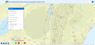
Tools for Community Planners
Understanding community-level strengths and vulnerabilities can help us prepare for emergencies like floods and heat waves. Every community has characteristics that make it more resilient in the face of some hazards and less resilient in the face of others.
Planning tools can be used to focus efforts on the areas at greatest risk or explore why some communities are more affected by a particular hazard. These same tools can also be used when there is a disease outbreak or an emergency to identify populations who may need more help with response and recovery. A community’s strengths and vulnerabilities are influenced by the systemic factors that affect who has access to decision-making power.
You will find a brief description of the Health Department’s planning tools below. Need help deciding which tool to use? Read this table to learn about the pros and cons of each index tool.
Looking for the Heat Vulnerability Index or Social Vulnerability Index? These tools were retired in 2026. For national data, you can explore the Center for Disease Control/Agency for Toxic Substances and Disease (CDC/AGTSD) Social Vulnerability Index. Check back soon for the new Vermont Heat Resilience Explorer.